Duration: 2h to 2h30 one way
Distance 5.6 km one way (11.2 km total) with 430 m elevation gain/loss
Difficulty: easy to expert. During winter, it is a difficult hike as the path is not marked and a high avalanche risk is expected in the area. during early spring, trail is easy as well marked but leave early before temperatures get too high and get back before mid-afternoon to avoid avalanche risk. During Summer, it is not possible to reach the glacier and not safe if you manage somehow.
Local guides can be booked to bring you safely to the glacier.
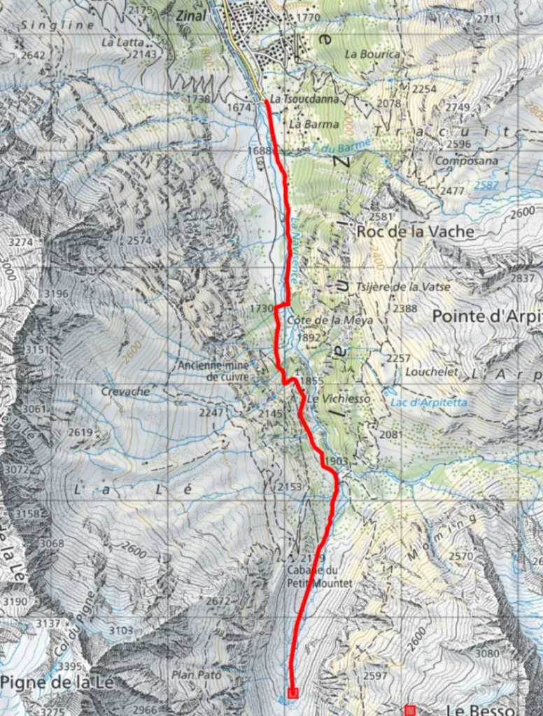
The hike starts at the “hiking parking” of Zinal. you reach while driving through the village all the way to the end of the road. Remember to pay that parking =)
From there on, two options are available.
- directly follow the trail along the river
- directly cross the bridge on your right
for safety reasons i would cross the bridge (option 2) first. Option 1 follows the mountain base and is an avalanche risk zone.
if you chose option 2, simply follow the ski and hiking trail along the river until you reach a formation of rocks and a yellow Trail sign.
if you opted for option 1 (and made it alive;) follow the trail till you reach the next bridge and cross it to reach that same yellow trail sign.
Eitherway, from that point, you will Follow “Roc de la vache blanc” (white/red/white – yellow sign). it will go up steeply for a km roughly and get less steep after that when you reached the entry of the glacier valley. From that point, 2 paths will lead to the glacier:
- one on the very right, close to the rock wall – watch out as stones and avalanches come done regularly
- a central one on top of the river – watch out as you are walking on top of water!
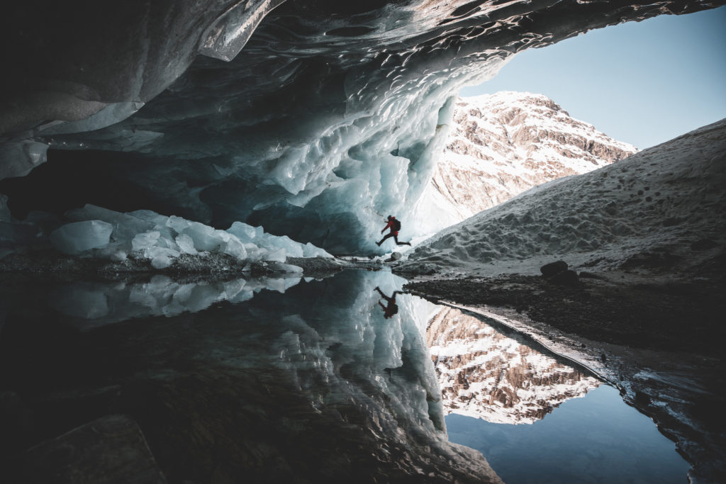
from there you will see the entry of the cave and will reach it quite soon!
enjoy, stay safe!
Note => if you plan on going further on top of the glacier, use ropes! only for experienced people. Glaciers have multiple holes and cliffs that are covered by snow and not visible to you.
Map of the trail, click here!
Looking for other hiking or travel destinations? Check here!
Looking for other places to stay ? check here!
Or do you simply have a question? Contact me!